Unmanned Aerial Vehicles (UAVs) have evolved rapidly over the last 10 years from being the preserve of the military to becoming viable products for both commercial and consumer markets. In this blog I will look at the huge opportunity already emerging for commercial UAVs and how much better it could be with cost-effective and robust Spatial AI systems integrated.
The global market for commercial UAVs is predicted to reach $6.1 billion by 2025 with applications ranging from agriculture to construction, search and rescue to environmental monitoring. UAVs are already helping businesses cover more ground, reach difficult or dangerous spaces, provide new and detailed intelligence and deliver services – sometimes with life and death consequences – quickly and effectively.
Applications from seeds to lifesaving
Agriculture is a huge market for UAVs, and a huge opportunity. Today drones are being equipped not only with cameras, but with a wide range of sensors, to help farmers monitor crop and field health. For example, the DJI P4 Multispectral is a five band multi spectral camera system that can access the entire light spectrum and gather information on plant health, chlorophyll levels, and potential stress to the plant.
UAVs can also deliver anything from seeds and water to precisely sprayed fertilizer and insecticide, across large areas quickly. At the same time they reduce waste and pollution by flying very close to the crops and focussing spray. Under lab conditions UAVs have even been used to pollinate flowers, a potentially critical role considering ongoing declines in bee populations.
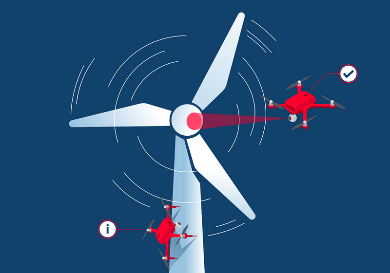
Uses in other sectors are rapidly becoming normal. In several construction, infrastructure and engineering fields, UAVs are regularly used for inspections. Airlines have begun to test UAVs for routine visual inspection of aircraft as part of their regular airworthiness reviews; mobile phone network operators use them to survey cell towers after storms, and UAVs are helping inspectors and engineers to get ‘eyes on’ difficult to access equipment or locations, at minimal risk and without disrupting work. Equipped with high-definition cameras and other sensors drones can fly close to buildings or other infrastructure and pick up the smallest of cracks or evidence of corrosion – without the expense and risk of sending human crews to assess physical assets that may be remote or dangerous.
For emergency response teams, getting into dangerous and unstable regions after accidents is essential, but must be done without risking further human lives. UAVs help here too – whether in surveying fires, searching for individuals, or detecting poisons or other chemicals – they are able to go quickly where manned vehicles cannot.
Try not to crash
Many of the UAVs used in these scenarios have been designed and built to be collision-resistant or collision-tolerant meaning that they can, to some extent, ‘bounce’ off surfaces without damaging themselves or the structure. However, it would ultimately be preferable for them to not crash into things at all no matter how demanding, changeable and ‘tight’ the space is.
Most are also still piloted by humans, and although regulations are changing (for example you can apply for beyond-line-of-sight exemptions in the US), operators are usually required to retain line of sight with the UAV. The need to have a human operator in control – or at least in a supervisory role – still limits the utility and the cost-effectiveness of UAV solutions in many cases. Fully autonomous UAVs, ones that can successfully and consistently navigate themselves will have an even greater impact on all of these scenarios and more.
Productivity boost
Imagine, rather than a farmer setting up and then flying a UAV across his fields, a swarm of low-cost autonomous robots constantly monitoring their fields. Knowing which areas had been checked, sprayed or otherwise tended, they would automatically navigate themselves to ensure the whole crop was inspected on a regular basis. Without human intervention the UAVs could undertake core farming functions 24/7 as well as collect data and insights that could massively improve productivity.
Or similarly, fleets of UAVs that routinely fly out to inspect infrastructure, from motorway bridges to cell-phone towers reporting back only when problems are spotted.
But today, navigating diverse landscapes, which change both with the seasons, but also rapidly with storms, moving equipment and even different lighting conditions, is virtually impossible for most commercial drones. The weight, not to mention the cost, of the sensors needed to accomplish this, plus the processing power and the need for very low-latency and high precision means that most current technologies cannot provide a solution that would allow this level of autonomous flying.
True auto-pilot for UAVs
At SLAMcore, we are working with leaders in the UAV field to address this problem and unleash the next generation of flying autonomous robots which will be able to navigate themselves. Our software can use inputs from two simple cameras, plus an inertia monitor to provide the intelligence for a UAV to navigate itself. These commercially available, low-cost and light-weight components can be added to even the most basic commercial UAVs in order to give them the capability to locate and map the environment around them and so navigate autonomously. Our solution is more accurate and reliable than GPS and can work inside and underneath infrastructure – there are no black-spots.
We hope to help the industry develop the low-cost, effective and reliable autonomous UAVs that will spur productivity, innovation and better, safer solutions across the whole spectrum of commercial sectors.